
Les Coteaux de Saint-Adrien topographic map
Interactive map
Click on the map to display elevation.
About this map
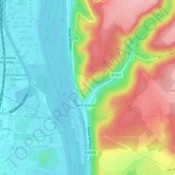
Name: Les Coteaux de Saint-Adrien topographic map, elevation, terrain.
Average elevation: 55 m
Minimum elevation: 1 m
Maximum elevation: 143 m
Other topographic maps
Click on a map to view its topography, its elevation and its terrain.
Le Becquet
Le Becquet, Belbeuf, Rouen, Seine-Maritime, Normandie, France métropolitaine, 76240, France
Average elevation: 47 m