
Lameschmillen topographic map
Interactive map
Click on the map to display elevation.
About this map
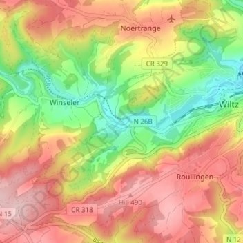
Name: Lameschmillen topographic map, elevation, terrain.
Location: Lameschmillen, Roullingen, Wiltz, Canton Wiltz, 9577, Luxembourg (49.94381 5.88450 49.98381 5.92450)
Average elevation: 416 m
Minimum elevation: 307 m
Maximum elevation: 510 m