
Little Elm topographic map
Click on the map to display elevation.
Little Elm
Little Elm is located at 33°9′50″N 96°55′49″W / 33.16389°N 96.93028°W / 33.16389; -96.93028 (33.163955, –96.930281). According to the U.S. Census Bureau, it has a total area of 18.6 square miles (48.3 km2), of which 14.6 square miles (37.7 km2) is land and 4.1 square miles (10.5 km2), or 21.83%, is covered by water. Little Elm has an average elevation of 545 feet above sea level.
About this map
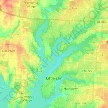
Name: Little Elm topographic map, elevation, terrain.
Location: Little Elm, Denton County, Texas, 75068, United States (33.13288 -96.97712 33.24046 -96.88197)
Average elevation: 171 m
Minimum elevation: 151 m
Maximum elevation: 197 m
Other topographic maps
Click on a map to view its topography, its elevation and its terrain.