
Brockworth topographic map
Interactive map
Click on the map to display elevation.
About this map
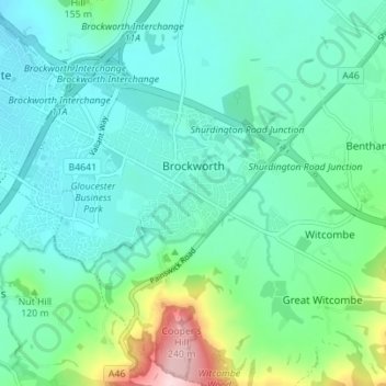
Name: Brockworth topographic map, elevation, terrain.
Average elevation: 82 m
Minimum elevation: 29 m
Maximum elevation: 283 m
Other topographic maps
Click on a map to view its topography, its elevation and its terrain.
Tewkesbury
Royaume-Uni > Angleterre > Gloucestershire > Tewkesbury
Tewkesbury, Gloucestershire, Angleterre, Royaume-Uni
Average elevation: 18 m