Geolocate

Tabernacle topographic map

Click on the map to display elevation.

About this map

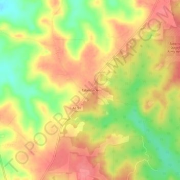
Name: Tabernacle topographic map, elevation, terrain.

Location: Tabernacle, Coffee County, Alabama, United States (31.43467 -85.88873 31.47467 -85.84873)

Average elevation: 119 m

Minimum elevation: 73 m

Maximum elevation: 150 m

Gear up for your next adventure:

Camping Groundsheet - Protect your tent from moisture and dirt
🥾Hiking Boots - Sturdy boots providing ankle support and traction on rugged trails
🧢Hiking Hat - Sun-protective and breathable hats for long treks
🔥Camping Stove - Portable stoves to cook outdoors with ease
💡Compact LED Flashlight - Powerful and portable flashlight for outdoor use

As an Amazon Associate, this site earns from qualifying purchases at no extra cost to you.