
Lake View topographic map
Interactive map
Click on the map to display elevation.
About this map
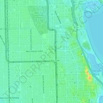
Name: Lake View topographic map, elevation, terrain.
Average elevation: 183 m
Minimum elevation: 174 m
Maximum elevation: 209 m
Other topographic maps
Click on a map to view its topography, its elevation and its terrain.
Loop
Vereinigte Staaten von Amerika > Illinois > Chicago
Loop, Chicago, Cook County, Illinois, Vereinigte Staaten von Amerika
Average elevation: 184 m