
Balaghat topographic map
Click on the map to display elevation.
Balaghat
Balaghat is located at 21°48′N 80°11′E / 21.800°N 80.183°E / 21.800; 80.183. It has an average elevation of 288 metres (944 feet).
About this map
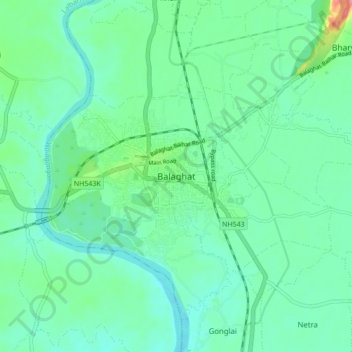
Name: Balaghat topographic map, elevation, terrain.
Average elevation: 304 m
Minimum elevation: 281 m
Maximum elevation: 384 m