Geolocate

Sumberjati topographic map

Click on the map to display elevation.

About this map

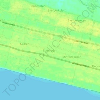
Name: Sumberjati topographic map, elevation, terrain.

Location: Sumberjati, Kebumen, Central Java, Java, Indonesia (-7.82217 109.73743 -7.78217 109.77743)

Average elevation: 9 m

Minimum elevation: 0 m

Maximum elevation: 16 m

Gear up for your next adventure:

🥾All-Terrain Hiking Boots - Versatile boots for varied hiking conditions
🛏️Camping Sleeping Mat - Comfortable mats for sleeping outdoors
🧦Thermal Socks - Warm socks for winter hiking or camping
🏃Hydration Running Vest - Carry water and maps close to your body for speed
🪑Insulated Seat Pad - Protect your seat from cold rocks and wet logs

As an Amazon Associate, this site earns from qualifying purchases at no extra cost to you.