
Udalguri topographic map
Click on the map to display elevation.
Udalguri
Odalguri is located at 26°44′43″N 92°05′46″E / 26.7452°N 92.0962°E / 26.7452; 92.0962. It has an average elevation of 180 metres (590 ft).
About this map
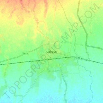
Name: Udalguri topographic map, elevation, terrain.
Average elevation: 109 m
Minimum elevation: 92 m
Maximum elevation: 137 m