Geolocate

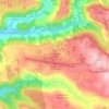
Campestre topographic map

Click on the map to display elevation.

About this map

Name: Campestre topographic map, elevation, terrain.

Location: Campestre, Chapecó, Região Geográfica Imediata de Chapecó, Região Geográfica Intermediária de Chapecó, Santa Catarina, Região Sul, 89801-971, Brasil (-27.15020 -52.62070 -27.13599 -52.60582)

Average elevation: 694 m

Minimum elevation: 608 m

Maximum elevation: 757 m

Other topographic maps

Click on a map to view its topography, its elevation and its terrain.

Cabeceira da Barragem

Brasil > Santa Catarina > Chapecó

Average elevation: 640 m

Palmital dos Fundos

Brasil > Santa Catarina > Chapecó

Average elevation: 594 m

Colônia Bacia

Brasil > Santa Catarina > Chapecó

Average elevation: 658 m

Gear up for your next adventure:

🥾Hiking Boots - Sturdy boots providing ankle support and traction on rugged trails
🔭Compact Binoculars - Lightweight optics for scouting trails and wildlife
🛶Kayak Dry Bag - Waterproof storage for kayaking adventures
⛺Bushcraft Tarp - Versatile emergency shelter or gear protection
🧥Softshell Hiking Jacket - The perfect balance of wind protection and breathability

As an Amazon Associate, this site earns from qualifying purchases at no extra cost to you.