
Boucle du Mouhoun topographic map
Interactive map
Click on the map to display elevation.
About this map
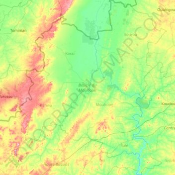
Name: Boucle du Mouhoun topographic map, elevation, terrain.
Location: Boucle du Mouhoun, Burkina Faso (11.24085 -4.64890 13.71449 -2.44140)
Average elevation: 307 m
Minimum elevation: 241 m
Maximum elevation: 585 m
Other topographic maps
Click on a map to view its topography, its elevation and its terrain.