Geolocate

Anupul topographic map

Click on the map to display elevation.

About this map

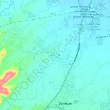
Name: Anupul topographic map, elevation, terrain.

Location: Anupul, Bamban, Tarlac, Central Luzon, 2327, Philippines (15.27092 120.54333 15.31092 120.58333)

Average elevation: 73 m

Minimum elevation: 51 m

Maximum elevation: 198 m

Other topographic maps

Click on a map to view its topography, its elevation and its terrain.

Marimla River

Philippines > Tarlac > Bamban > Lourdes

Average elevation: 79 m

Gear up for your next adventure:

🧰Emergency Multi-Tool - Compact multi-tool for outdoor survival
🎒Backpack Rain Cover - External shield to keep your entire pack dry
🛶Waterproof Dry Bags - Keep electronics and clothes dry during river crossings
🕯️Camping Lantern - Illuminates your entire campsite with high-efficiency LEDs
🔭Compact Binoculars - Lightweight optics for scouting trails and wildlife

As an Amazon Associate, this site earns from qualifying purchases at no extra cost to you.