
Lutremange topographic map
Interactive map
Click on the map to display elevation.
About this map
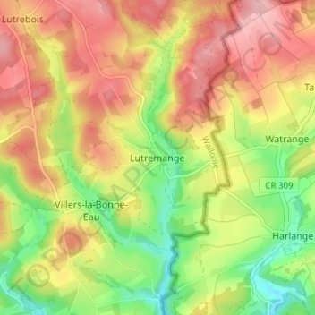
Name: Lutremange topographic map, elevation, terrain.
Location: Lutremange, Bastenaken, Luxemburg, Wallonië, 6600, België (49.92132 5.74081 49.96132 5.78081)
Average elevation: 471 m
Minimum elevation: 395 m
Maximum elevation: 538 m