Geolocate

Kalath topographic map

Click on the map to display elevation.

About this map

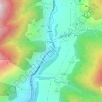
Name: Kalath topographic map, elevation, terrain.

Location: Kalath, Manali, Kullu, Himachal Pradesh, 175143, India (32.16895 77.16892 32.20895 77.20892)

Average elevation: 2,058 m

Minimum elevation: 1,609 m

Maximum elevation: 2,991 m

Gear up for your next adventure:

🥽Outdoor Goggles - Protective eyewear for outdoor activities
🥾Waterproof Hiking Boots - Essential footwear for rugged terrain and wet Canadian trails
🛁Quick-Dry Microfiber Towel - Space-saving towel that dries rapidly on the move
🥾Trail Hiking Socks - Comfortable socks to prevent blisters and fatigue
🧢Outdoor Cap - Protective cap for sun and rain during hikes

As an Amazon Associate, this site earns from qualifying purchases at no extra cost to you.