Geolocate

Vejbystrand topographic map

Click on the map to display elevation.

About this map

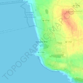
Name: Vejbystrand topographic map, elevation, terrain.

Location: Vejbystrand, Skåne County, 266 52, Sweden (56.29421 12.74561 56.33421 12.78561)

Average elevation: 10 m

Minimum elevation: -1 m

Maximum elevation: 39 m

Gear up for your next adventure:

🦌Outdoor Trail Camera - Monitor wildlife activity near your favorite spots
🧦Hiking Socks - Moisture-wicking and comfortable socks for long hikes
🔦LED Headtorch - Bright and durable light for night activities
🧰Survival Kit - Essential gear for emergencies in the wilderness
🛶Kayak Accessories - Essential gear for safe and fun kayaking adventures

As an Amazon Associate, this site earns from qualifying purchases at no extra cost to you.