Geolocate

Pelem topographic map

Click on the map to display elevation.

About this map

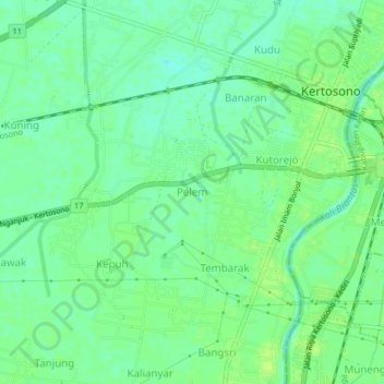
Name: Pelem topographic map, elevation, terrain.

Location: Pelem, Nganjuk, East Java, Java, 64315, Indonesia (-7.62341 112.07244 -7.58341 112.11244)

Average elevation: 43 m

Minimum elevation: 36 m

Maximum elevation: 49 m

Other topographic maps

Click on a map to view its topography, its elevation and its terrain.

Ngronggot

Indonesia > East Java > Nganjuk

Average elevation: 50 m

Ngronggot

Indonesia > East Java > Nganjuk

Average elevation: 51 m

Kaloran

Indonesia > East Java > Nganjuk

Average elevation: 46 m

Kelurahan

Indonesia > East Java > Nganjuk

Average elevation: 47 m

Banjarsari

Indonesia > East Java > Nganjuk

Average elevation: 49 m

Gear up for your next adventure:

Camping Essentials - All-in-one gear for a comfortable camping trip
🧦Thermal Socks - Warm socks for winter hiking or camping
🧤Thermal Hiking Gloves - Grip-enhanced gloves for cold-weather altitude trekking
🚲Handlebar Phone Mount - View topographic-map.com live while cycling
🏕️Camping Hammock - Integrated protection for sleeping between trees

As an Amazon Associate, this site earns from qualifying purchases at no extra cost to you.