Geolocate

Kodachadri topographic map

Click on the map to display elevation.

About this map

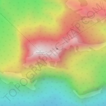
Name: Kodachadri topographic map, elevation, terrain.

Location: Kodachadri, Sagara taluk, Shimoga, Karnataka, India (13.85713 74.86716 13.85723 74.86726)

Average elevation: 811 m

Minimum elevation: 307 m

Maximum elevation: 1,323 m

Gear up for your next adventure:

🪑Insulated Seat Pad - Protect your seat from cold rocks and wet logs
💡LED Headlamp - Hands-free illumination for night hiking and camping
💧Collapsible Water Bottle - Space-saving water bottle for outdoor activities
🧣Evaporative Cooling Towel - Beat the heat during intense summer climbs
🚲Heavy Duty Bike Lock - Secure your bike at the trailhead or during stops

As an Amazon Associate, this site earns from qualifying purchases at no extra cost to you.