
Make a donation
Gear up for your next adventure:
As an Amazon Associate, this site earns from qualifying purchases at no extra cost to you.
Silberborn topographic map
Click on the map to display elevation.
Make a donation
Gear up for your next adventure:
As an Amazon Associate, this site earns from qualifying purchases at no extra cost to you.
Silberborn
Der Ortsteil Torfhaus, der aus wenigen Gebäuden besteht, liegt auf der Silberborner Hochebene 1,25 Kilometer östlich vom Silberborner Ortskern an der Landesstraße 549 auf etwa 490 m Höhe, womit er die höchstgelegene Ortschaft des Solling ist.
Make a donation
Gear up for your next adventure:
As an Amazon Associate, this site earns from qualifying purchases at no extra cost to you.
About this map
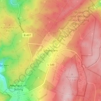
Name: Silberborn topographic map, elevation, terrain.
Average elevation: 447 m
Minimum elevation: 316 m
Maximum elevation: 526 m
Make a donation
Gear up for your next adventure:
As an Amazon Associate, this site earns from qualifying purchases at no extra cost to you.