
Thank you for supporting this site ❤️
Make a donation
Make a donation
Gear up for your next adventure:
As an Amazon Associate, this site earns from qualifying purchases at no extra cost to you.
Bagya topographic map
Click on the map to display elevation.
Thank you for supporting this site ❤️
Make a donation
Make a donation
Gear up for your next adventure:
As an Amazon Associate, this site earns from qualifying purchases at no extra cost to you.
About this map
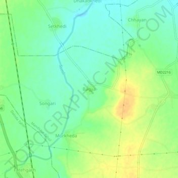
Name: Bagya topographic map, elevation, terrain.
Location: Bagya, Mandsaur Tahsil, Mandsaur, Madhya Pradesh, India (23.97737 75.09479 24.01737 75.13479)
Average elevation: 452 m
Minimum elevation: 438 m
Maximum elevation: 469 m
Thank you for supporting this site ❤️
Make a donation
Make a donation
Gear up for your next adventure:
As an Amazon Associate, this site earns from qualifying purchases at no extra cost to you.