Geolocate

Giddalur topographic map

Click on the map to display elevation.

About this map

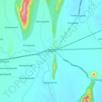
Name: Giddalur topographic map, elevation, terrain.

Location: Giddalur, Prakasam, Andhra Pradesh, 523357, India (15.33840 78.88652 15.41840 78.96652)

Average elevation: 274 m

Minimum elevation: 246 m

Maximum elevation: 512 m

Gear up for your next adventure:

🛶Waterproof Dry Bags - Keep electronics and clothes dry during river crossings
🔪Outdoor Multitool - Versatile tool for repairs and food prep in the wild
💡LED Camping Lantern - Illuminate your campsite with long-lasting lanterns
🏃Hydration Running Vest - Carry water and maps close to your body for speed
🧳Compression Sacks - Maximize space in your backpack by shrinking gear

As an Amazon Associate, this site earns from qualifying purchases at no extra cost to you.