
Thank you for supporting this site ❤️
Make a donation
Make a donation
Gear up for your next adventure:
As an Amazon Associate, this site earns from qualifying purchases at no extra cost to you.
Bousselam topographic map
Click on the map to display elevation.
Thank you for supporting this site ❤️
Make a donation
Make a donation
Gear up for your next adventure:
As an Amazon Associate, this site earns from qualifying purchases at no extra cost to you.
About this map
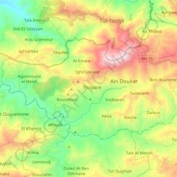
Name: Bousselam topographic map, elevation, terrain.
Location: Bousselam, Daïra Bouandas, Sétif, 19124, Algérie (36.45930 4.93346 36.52868 5.08360)
Average elevation: 816 m
Minimum elevation: 269 m
Maximum elevation: 1,626 m
Thank you for supporting this site ❤️
Make a donation
Make a donation
Gear up for your next adventure:
As an Amazon Associate, this site earns from qualifying purchases at no extra cost to you.