Geolocate

855 topographic map

Click on the map to display elevation.

About this map

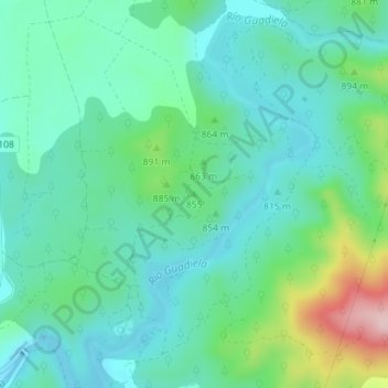
Name: 855 topographic map, elevation, terrain.

Location: 855, Alcantud, Cuenca, Castile-La Mancha, 16812, Spain (40.52008 -2.30896 40.52018 -2.30886)

Average elevation: 835 m

Minimum elevation: 774 m

Maximum elevation: 1,030 m

Gear up for your next adventure:

🛶Kayak Accessories - Essential gear for safe and fun kayaking adventures
🦟Insect Repellent - Keep mosquitoes and black flies away in wooded areas
🛶Waterproof Dry Bags - Keep electronics and clothes dry during river crossings
👟Leg Gaiters - Keep debris, mud, and snow out of your boots
🧢Hiking Sun Hat - Wide-brimmed protection for exposed mountain ridges

As an Amazon Associate, this site earns from qualifying purchases at no extra cost to you.