
Thank you for supporting this site ❤️
Make a donation
Make a donation
Gear up for your next adventure:
As an Amazon Associate, this site earns from qualifying purchases at no extra cost to you.
Ujalaiwadi topographic map
Click on the map to display elevation.
Thank you for supporting this site ❤️
Make a donation
Make a donation
Gear up for your next adventure:
As an Amazon Associate, this site earns from qualifying purchases at no extra cost to you.
About this map
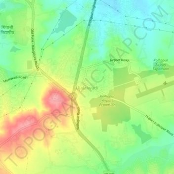
Name: Ujalaiwadi topographic map, elevation, terrain.
Location: Ujalaiwadi, Kolhapur, Maharashtra, 416004, India (16.64463 74.25069 16.68463 74.29069)
Average elevation: 602 m
Minimum elevation: 557 m
Maximum elevation: 663 m
Thank you for supporting this site ❤️
Make a donation
Make a donation
Gear up for your next adventure:
As an Amazon Associate, this site earns from qualifying purchases at no extra cost to you.