Geolocate

Malkini topographic map

Click on the map to display elevation.

About this map

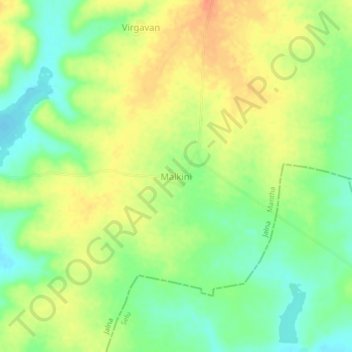
Name: Malkini topographic map, elevation, terrain.

Location: Malkini, Mantha, Jalna, Maharashtra, India (19.65779 76.43717 19.69779 76.47717)

Average elevation: 482 m

Minimum elevation: 459 m

Maximum elevation: 504 m

Other topographic maps

Click on a map to view its topography, its elevation and its terrain.

Mantha

India > Maharashtra > Mantha

Average elevation: 488 m

Gear up for your next adventure:

🔋Solar Power Bank - Keep your GPS and devices charged during long outdoor trips
👟Trail Running Shoes - Agile footwear for fast-paced topographic exploration
🗺️Topographic Maps - Detailed maps to explore trails, mountains, and wilderness areas
🦟Insect Repellent - Keep mosquitoes and black flies away in wooded areas
🔥Emergency Fire Starter - Reliable ignition source for all weather conditions

As an Amazon Associate, this site earns from qualifying purchases at no extra cost to you.