
Ottlar topographic map
Interactive map
Click on the map to display elevation.
About this map
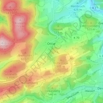
Name: Ottlar topographic map, elevation, terrain.
Average elevation: 526 m
Minimum elevation: 381 m
Maximum elevation: 726 m
Other topographic maps
Click on a map to view its topography, its elevation and its terrain.
Korbach
Deutschland > Hessen > Landkreis Waldeck-Frankenberg > Korbach
Korbach, Landkreis Waldeck-Frankenberg, Hessen, 34497, Deutschland
Average elevation: 389 m