
Make a donation
Gear up for your next adventure:
As an Amazon Associate, this site earns from qualifying purchases at no extra cost to you.
Afritzer See topographic map
Click on the map to display elevation.
Make a donation
Gear up for your next adventure:
As an Amazon Associate, this site earns from qualifying purchases at no extra cost to you.
Afritzer See
Der See liegt im Gegendtal in den Nockbergen auf einer Höhe von 752 m ü. A. zwischen dem Wöllaner Nock und dem Mirnock. Er liegt am Südrand des Gemeindegebiets von Feld am See, teilweise folgt die Gemeindegrenze zu Afritz der Uferlinie. Das Südostufer ist zu großen Teilen unberührt. Am Nordostufer verläuft die Millstätter Straße (B 98).
Make a donation
Gear up for your next adventure:
As an Amazon Associate, this site earns from qualifying purchases at no extra cost to you.
About this map
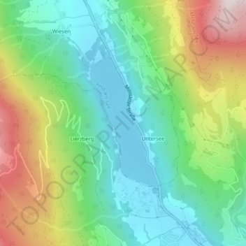
Name: Afritzer See topographic map, elevation, terrain.
Average elevation: 1,022 m
Minimum elevation: 740 m
Maximum elevation: 1,566 m
Make a donation
Gear up for your next adventure:
As an Amazon Associate, this site earns from qualifying purchases at no extra cost to you.