
Thank you for supporting this site ❤️
Make a donation
Make a donation
Gear up for your next adventure:
As an Amazon Associate, this site earns from qualifying purchases at no extra cost to you.
Al `Asharah topographic map
Click on the map to display elevation.
Thank you for supporting this site ❤️
Make a donation
Make a donation
Gear up for your next adventure:
As an Amazon Associate, this site earns from qualifying purchases at no extra cost to you.
About this map
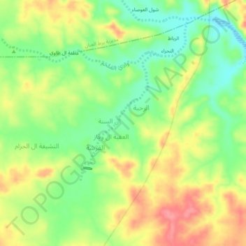
Name: Al `Asharah topographic map, elevation, terrain.
Location: Al `Asharah, Rajuzah district, Al Jawf Governorate, Yemen (16.73030 44.41824 16.77030 44.45824)
Average elevation: 2,052 m
Minimum elevation: 2,013 m
Maximum elevation: 2,094 m
Thank you for supporting this site ❤️
Make a donation
Make a donation
Gear up for your next adventure:
As an Amazon Associate, this site earns from qualifying purchases at no extra cost to you.
Other topographic maps
Click on a map to view its topography, its elevation and its terrain.