Geolocate

Herington topographic map

Click on the map to display elevation.

About this map

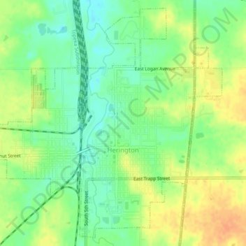
Name: Herington topographic map, elevation, terrain.

Location: Herington, Dickinson County, Kansas, United States (38.65952 -96.96722 38.68979 -96.92572)

Average elevation: 415 m

Minimum elevation: 397 m

Maximum elevation: 434 m

Other topographic maps

Click on a map to view its topography, its elevation and its terrain.

Industry

United States > Kansas > Dickinson County

Average elevation: 370 m

Gear up for your next adventure:

🧥Ultralight Puffy Jacket - Maximum warmth that packs down to the size of an orange
🧳Compression Sacks - Maximize space in your backpack by shrinking gear
🧥Fleece Jacket - Warm and lightweight jacket for layering
🥾Trail Hiking Shoes - Durable shoes designed for rugged trails
🧣Evaporative Cooling Towel - Beat the heat during intense summer climbs

As an Amazon Associate, this site earns from qualifying purchases at no extra cost to you.