
Thank you for supporting this site ❤️
Make a donation
Make a donation
Gear up for your next adventure:
As an Amazon Associate, this site earns from qualifying purchases at no extra cost to you.
Kodavasal topographic map
Click on the map to display elevation.
Thank you for supporting this site ❤️
Make a donation
Make a donation
Gear up for your next adventure:
As an Amazon Associate, this site earns from qualifying purchases at no extra cost to you.
About this map
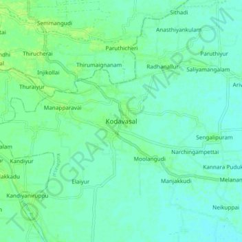
Name: Kodavasal topographic map, elevation, terrain.
Location: Kodavasal, Kudavasal, Thiruvarur, Tamil Nadu, 612600, India (10.81528 79.44096 10.89528 79.52096)
Average elevation: 19 m
Minimum elevation: 14 m
Maximum elevation: 26 m
Thank you for supporting this site ❤️
Make a donation
Make a donation
Gear up for your next adventure:
As an Amazon Associate, this site earns from qualifying purchases at no extra cost to you.