Geolocate

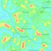
Maripuzha topographic map

Click on the map to display elevation.

About this map

Name: Maripuzha topographic map, elevation, terrain.

Location: Maripuzha, Thamarassery, Kozhikode district, Kerala, India (11.43160 76.08157 11.47160 76.12157)

Average elevation: 935 m

Minimum elevation: 431 m

Maximum elevation: 1,968 m

Other topographic maps

Click on a map to view its topography, its elevation and its terrain.
Malapuram

India > Kerala > Thamarassery > Engapuzha

Average elevation: 54 m

Perumbilly

India > Kerala > Thamarassery > Engapuzha

Average elevation: 68 m

Theyyappara

India > Kerala > Thamarassery > Kodencherry

Average elevation: 58 m

Kakkadam Poyil

India > Kerala > Thamarassery > Kakkadampoyil

Average elevation: 593 m

Narikunni

India > Kerala > Thamarassery > Palangad

Average elevation: 48 m

Gear up for your next adventure:

🥾Hiking Shorts - Breathable shorts suitable for summer hikes
🥾Trail Hiking Shoes - Durable shoes designed for rugged trails
⛺Lightweight Camping Tent - Portable shelter optimized for Canadian backcountry camping
🥾Waterproof Hiking Boots - Boots keeping your feet dry in wet conditions
🛶Kayak Dry Bag - Waterproof storage for kayaking adventures

As an Amazon Associate, this site earns from qualifying purchases at no extra cost to you.