Geolocate

Phata topographic map

Click on the map to display elevation.

About this map

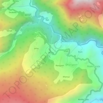
Name: Phata topographic map, elevation, terrain.

Location: Phata, Ukhimath, Rudraprayag, Uttarakhand, India (30.55770 79.01977 30.59770 79.05977)

Average elevation: 1,825 m

Minimum elevation: 1,247 m

Maximum elevation: 2,639 m

Gear up for your next adventure:

🥾Mountain Hiking Boots - High-traction boots for rocky terrain
🧴Insect Repellent - Protect yourself from bugs during outdoor adventures
Camping Tent - Weather-resistant tents suitable for 2 to 6 people
🥾Mountain Hiking Shoes - Shoes with superior grip for mountainous terrain
🧥Waterproof Jacket - Lightweight rain jackets for hiking and outdoor activities

As an Amazon Associate, this site earns from qualifying purchases at no extra cost to you.