Geolocate

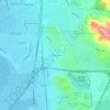
Vallejo topographic map

Click on the map to display elevation.

About this map

Name: Vallejo topographic map, elevation, terrain.

Location: Vallejo, Solano County, California, United States (38.05938 -122.38755 38.17350 -122.16615)

Average elevation: 45 m

Minimum elevation: -5 m

Maximum elevation: 337 m

Other topographic maps

Click on a map to view its topography, its elevation and its terrain.
Mare Island

United States > California > Solano County > Vallejo

Average elevation: 107 m

Molena

United States > California > Solano County

Average elevation: 22 m

Vallejo

United States > California > Solano County > Vallejo

Average elevation: 47 m

Clima

United States > California > Solano County

Average elevation: 13 m

Creed

United States > California > Solano County

Average elevation: 12 m

Bunker

United States > California > Solano County

Average elevation: 5 m

Gear up for your next adventure:

🥾Approach Shoes - Shoes designed for climbing approaches and rugged trails
💡Compact LED Flashlight - Powerful and portable flashlight for outdoor use
🥾Hiking Gaiters - Protect legs and shoes from mud, snow, and debris
🧥Ultralight Puffy Jacket - Maximum warmth that packs down to the size of an orange
⛺Family Camping Tent - Spacious tent suitable for family camping trips

As an Amazon Associate, this site earns from qualifying purchases at no extra cost to you.