Geolocate

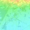
Francolise topographic map

Click on the map to display elevation.

About this map

Name: Francolise topographic map, elevation, terrain.

Location: Francolise, Caserta, Campania, Italia (41.10948 14.02010 41.21647 14.09949)

Average elevation: 43 m

Minimum elevation: 3 m

Maximum elevation: 224 m

Other topographic maps

Click on a map to view its topography, its elevation and its terrain.
Destra Volturno

Italia > Campania > Caserta > Castel Volturno

Average elevation: 1 m

Borgo Appio

Italia > Campania > Caserta > Grazzanise

Average elevation: 8 m

Sant'Andrea del Pizzone

Italia > Campania > Caserta

Average elevation: 15 m

Casola

Italia > Campania > Caserta > Caserta

Average elevation: 317 m

Pugliano

Italia > Campania > Caserta > Teano

Average elevation: 189 m

Sant'Agata

Italia > Campania > Caserta > Sessa Aurunca > Avezzano-Sorbello

Average elevation: 190 m

Vallelunga

Italia > Campania > Caserta > Gallo Matese

Average elevation: 783 m

Sepicciano

Italia > Campania > Caserta > Piedimonte Matese > Sepicciano

Average elevation: 315 m

Pellegrino

Italia > Campania > Caserta > Pontelatone

Average elevation: 194 m

Mezzano

Italia > Campania > Caserta > Caserta

Average elevation: 207 m

Gear up for your next adventure:

🔋Lithium AA Batteries - Long-lasting power that performs in extreme cold
💡LED Headlamp - Hands-free illumination for night hiking and camping
🏃Hydration Running Vest - Carry water and maps close to your body for speed
🥾Durable Hiking Shoes - Long-lasting shoes for frequent hiking
🧤Thermal Hiking Gloves - Grip-enhanced gloves for cold-weather altitude trekking

As an Amazon Associate, this site earns from qualifying purchases at no extra cost to you.