
DeRidder topographic map
Click on the map to display elevation.
DeRidder
DeRidder is located in northern Beauregard Parish at 30°51′5″N 93°17′25″W / 30.85139°N 93.29028°W / 30.85139; -93.29028 (30.851419, -93.290230) and has an elevation of 203 feet (61.9 m). U.S. Route 171 leads south 48 miles (77 km) to Lake Charles and north 15 miles (24 km) to the entrance to Fort Johnson and 21 miles (34 km) to Leesville. U.S. Route 190 leads south and east 49 miles (79 km) to Kinder and west 52 miles (84 km) to Jasper, Texas.
About this map
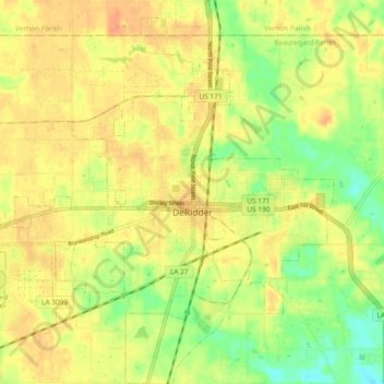
Name: DeRidder topographic map, elevation, terrain.
Location: DeRidder, Beauregard Parish, Louisiana, United States (30.81026 -93.34710 30.89045 -93.25487)
Average elevation: 58 m
Minimum elevation: 35 m
Maximum elevation: 73 m
Other topographic maps
Click on a map to view its topography, its elevation and its terrain.