
Thank you for supporting this site ❤️
Make a donation
Make a donation
Gear up for your next adventure:
As an Amazon Associate, this site earns from qualifying purchases at no extra cost to you.
Frasnes-lez-Anvaing topographic map
Click on the map to display elevation.
Thank you for supporting this site ❤️
Make a donation
Make a donation
Gear up for your next adventure:
As an Amazon Associate, this site earns from qualifying purchases at no extra cost to you.
About this map
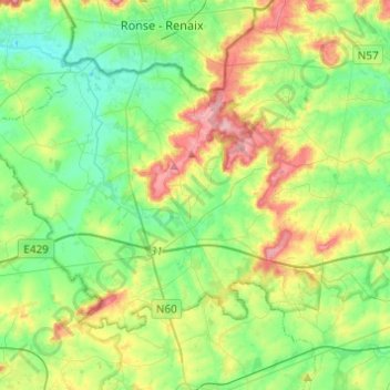
Name: Frasnes-lez-Anvaing topographic map, elevation, terrain.
Location: Frasnes-lez-Anvaing, Ath, Hainaut, Wallonia, Belgium (50.62591 3.48732 50.73473 3.73140)
Average elevation: 56 m
Minimum elevation: 12 m
Maximum elevation: 145 m
Thank you for supporting this site ❤️
Make a donation
Make a donation
Gear up for your next adventure:
As an Amazon Associate, this site earns from qualifying purchases at no extra cost to you.