Geolocate

Úbeda topographic map

Click on the map to display elevation.

About this map

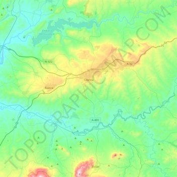
Name: Úbeda topographic map, elevation, terrain.

Location: Úbeda, Jaén, Andalusia, Spain (37.81965 -3.43358 38.16635 -3.13221)

Average elevation: 497 m

Minimum elevation: 257 m

Maximum elevation: 1,309 m

Other topographic maps

Click on a map to view its topography, its elevation and its terrain.

El Conde

Spain > Andalusia > Úbeda

Average elevation: 420 m

Gear up for your next adventure:

🧭GPS Outdoor Watch - Smart watch for navigation and fitness tracking in nature
🧢Outdoor Visor - Breathable visor for sunny hikes
🧦Outdoor Socks - Durable socks designed for hiking and outdoor sports
🧦Crew Hiking Socks - Comfortable socks for long-distance hikes
🕶️Polarized Sunglasses - Reduces glare from snow and water at high elevations

As an Amazon Associate, this site earns from qualifying purchases at no extra cost to you.