
Wienhagen topographic map
Interactive map
Click on the map to display elevation.
About this map
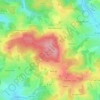
Name: Wienhagen topographic map, elevation, terrain.
Average elevation: 414 m
Minimum elevation: 354 m
Maximum elevation: 480 m
Other topographic maps
Click on a map to view its topography, its elevation and its terrain.
Glietenberg
Deutschland > Nordrhein-Westfalen > Märkischer Kreis > Kierspe
Glietenberg, Kierspe, Märkischer Kreis, Nordrhein-Westfalen, Deutschland
Average elevation: 381 m