
Thank you for supporting this site ❤️
Make a donation
Make a donation
Gear up for your next adventure:
As an Amazon Associate, this site earns from qualifying purchases at no extra cost to you.
Z'nata topographic map
Click on the map to display elevation.
Thank you for supporting this site ❤️
Make a donation
Make a donation
Gear up for your next adventure:
As an Amazon Associate, this site earns from qualifying purchases at no extra cost to you.
About this map
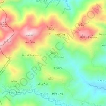
Name: Z'nata topographic map, elevation, terrain.
Location: Z'nata, Eraguene, Ziama Mansouriah District, Jijel, Algeria (36.53037 5.51755 36.57037 5.55755)
Average elevation: 925 m
Minimum elevation: 689 m
Maximum elevation: 1,263 m
Thank you for supporting this site ❤️
Make a donation
Make a donation
Gear up for your next adventure:
As an Amazon Associate, this site earns from qualifying purchases at no extra cost to you.