
Thank you for supporting this site ❤️
Make a donation
Make a donation
Gear up for your next adventure:
As an Amazon Associate, this site earns from qualifying purchases at no extra cost to you.
Hertingshausen topographic map
Click on the map to display elevation.
Thank you for supporting this site ❤️
Make a donation
Make a donation
Gear up for your next adventure:
As an Amazon Associate, this site earns from qualifying purchases at no extra cost to you.
About this map
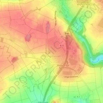
Name: Hertingshausen topographic map, elevation, terrain.
Location: Hertingshausen, Baunatal, Landkreis Kassel, Hessen, Deutschland (51.22023 9.39321 51.24217 9.43797)
Average elevation: 218 m
Minimum elevation: 166 m
Maximum elevation: 248 m
Thank you for supporting this site ❤️
Make a donation
Make a donation
Gear up for your next adventure:
As an Amazon Associate, this site earns from qualifying purchases at no extra cost to you.