Geolocate

Colle Aprico topographic map

Click on the map to display elevation.

About this map

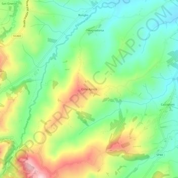
Name: Colle Aprico topographic map, elevation, terrain.

Location: Colle Aprico, Arcevia, Ancona, Marche, 60011, Italy (43.49116 12.96555 43.53116 13.00555)

Average elevation: 254 m

Minimum elevation: 153 m

Maximum elevation: 422 m

Gear up for your next adventure:

🧦Crew Hiking Socks - Comfortable socks for long-distance hikes
🧥Softshell Hiking Jacket - The perfect balance of wind protection and breathability
🦶Hiking Shoe Insoles - Added support for high arches and long days on feet
🛶Canoe Life Vest - Safety vest for water sports
🧦Hiking Socks - Moisture-wicking and comfortable socks for long hikes

As an Amazon Associate, this site earns from qualifying purchases at no extra cost to you.