Geolocate

Villanova topographic map

Click on the map to display elevation.

About this map

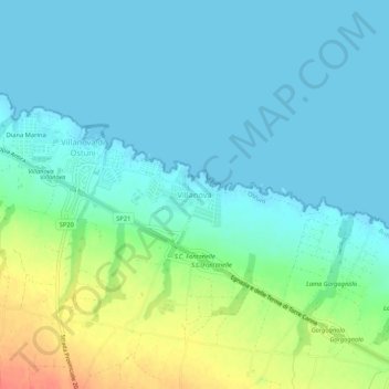
Name: Villanova topographic map, elevation, terrain.

Location: Villanova, Ostuni, Brindisi, Puglia, Italia (40.76512 17.58095 40.80512 17.62095)

Average elevation: 13 m

Minimum elevation: -2 m

Maximum elevation: 49 m

Gear up for your next adventure:

🛏️Camping Sleeping Mat - Comfortable mats for sleeping outdoors
Family Camping Tent - Spacious tent suitable for family camping trips
🥾Waterproof Hiking Boots - Boots keeping your feet dry in wet conditions
📷Outdoor Action Camera - Capture high-elevation views and rugged adventures
🥾Hiking Gaiters - Protect legs and shoes from mud, snow, and debris

As an Amazon Associate, this site earns from qualifying purchases at no extra cost to you.