Mahabaleshwar topographic map
Interactive map
Click on the map to display elevation.
About this map
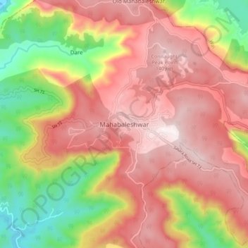
Name: Mahabaleshwar topographic map, elevation, terrain.
Location: Mahabaleshwar, Satara, Maharashtra, 412806, India (17.88428 73.61758 17.96428 73.69758)
Average elevation: 1,112 m
Minimum elevation: 668 m
Maximum elevation: 1,436 m
Other topographic maps
Click on a map to view its topography, its elevation and its terrain.
Panchgani
India > Maharashtra > Mahabaleshwar
Panchgani, Mahabaleshwar, Satara, Maharashtra, 412805, India
Average elevation: 1,019 m
Metgothar
India > Maharashtra > Mahabaleshwar > Avakali
Metgothar, Avakali, Mahabaleshwar, Satara District, Maharashtra, India
Average elevation: 1,199 m