
Madura topographic map
Interactive map
Click on the map to display elevation.
About this map
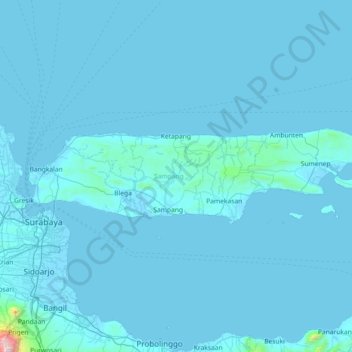
Name: Madura topographic map, elevation, terrain.
Location: Madura, Sampang, Jatim, Indonesia (-7.25403 112.67349 -6.86327 114.12546)
Average elevation: 29 m
Minimum elevation: -2 m
Maximum elevation: 3,281 m
Other topographic maps
Click on a map to view its topography, its elevation and its terrain.
Cemoro Lawang
Indonesia > Jatim > Cemoro Lawang
Cemoro Lawang, Probolinggo, Jatim, Indonesia
Average elevation: 2,171 m