
Keisterville topographic map
Interactive map
Click on the map to display elevation.
About this map
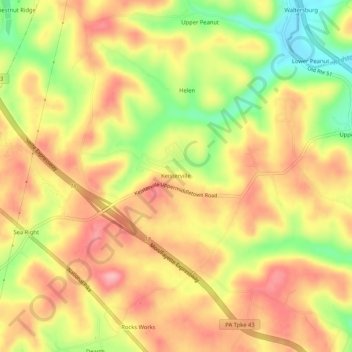
Name: Keisterville topographic map, elevation, terrain.
Average elevation: 347 m
Minimum elevation: 270 m
Maximum elevation: 401 m
Other topographic maps
Click on a map to view its topography, its elevation and its terrain.
Smock
United States > Pennsylvania > Fayette County > Menallen Township
Smock, Menallen Township, Fayette County, Pennsylvania, 15480, United States
Average elevation: 324 m
New Salem
United States > Pennsylvania > Fayette County > Menallen Township
New Salem, Menallen Township, Fayette County, Pennsylvania, 15648, United States
Average elevation: 331 m