Geolocate

Matarani topographic map

Click on the map to display elevation.

About this map

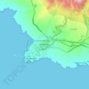
Name: Matarani topographic map, elevation, terrain.

Location: Matarani, Islay, Arequipa, Perú (-17.03997 -72.13335 -16.95997 -72.05335)

Average elevation: 110 m

Minimum elevation: 0 m

Maximum elevation: 701 m

Gear up for your next adventure:

🧥Softshell Jacket - Windproof and breathable jacket for hiking
🦶Anti-Blister Balm - Prevents friction and hotspots during long ascents
🥾Approach Boots - Comfortable boots for hiking and climbing approaches
Family Camping Tent - Spacious tent suitable for family camping trips
🗺️Topographic Maps - Detailed maps to explore trails, mountains, and wilderness areas

As an Amazon Associate, this site earns from qualifying purchases at no extra cost to you.