
Amberley topographic map
Click on the map to display elevation.
About this map
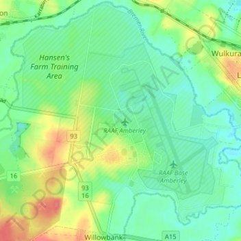
Name: Amberley topographic map, elevation, terrain.
Location: Amberley, Ipswich City, Queensland, 4306, Australia (-27.65847 152.66753 -27.60232 152.73163)
Average elevation: 34 m
Minimum elevation: 14 m
Maximum elevation: 71 m
Other topographic maps
Click on a map to view its topography, its elevation and its terrain.