Geolocate

Mount Raung topographic map

Click on the map to display elevation.

About this map

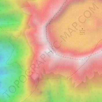
Name: Mount Raung topographic map, elevation, terrain.

Location: Mount Raung, Bondowoso, East Java, Jawa, Indonesia (-8.12562 114.04662 -8.12552 114.04672)

Average elevation: 2,808 m

Minimum elevation: 1,964 m

Maximum elevation: 3,285 m

Gear up for your next adventure:

🌬️Windproof Camp Stove - Efficient cooking even on exposed mountain peaks
🧥Ultralight Puffy Jacket - Maximum warmth that packs down to the size of an orange
👟Trail Running Shoes - Agile footwear for fast-paced topographic exploration
🛏️Sleeping Bag - Warm and compact sleeping bags for outdoor camping
🧥Fleece Jacket - Warm and lightweight jacket for layering

As an Amazon Associate, this site earns from qualifying purchases at no extra cost to you.