Geolocate

Tierra Colorada topographic map

Click on the map to display elevation.

About this map

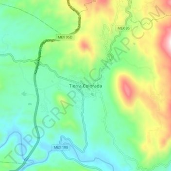
Name: Tierra Colorada topographic map, elevation, terrain.

Location: Tierra Colorada, Juan R. Escudero, Guerrero, Mexico (17.12611 -99.56944 17.20611 -99.48944)

Average elevation: 392 m

Minimum elevation: 120 m

Maximum elevation: 1,022 m

Gear up for your next adventure:

🔋Emergency Crank Radio - Weather alerts and power without needing batteries
🛶Canoe Life Vest - Safety vest for water sports
🧢Sun Protection Cap - Breathable cap to protect from sun exposure
🔨Vehicle Emergency Tool - Safety tool for remote road trips to trailheads
🕶️Polarized Sunglasses - Reduces glare from snow and water at high elevations

As an Amazon Associate, this site earns from qualifying purchases at no extra cost to you.