
Make a donation
Gear up for your next adventure:
As an Amazon Associate, this site earns from qualifying purchases at no extra cost to you.
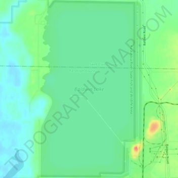
Baldwin Lake topographic map
Click on the map to display elevation.
Make a donation
Gear up for your next adventure:
As an Amazon Associate, this site earns from qualifying purchases at no extra cost to you.
Baldwin Lake
Baldwin Lake is a 2,018-acre (817 ha) reservoir which spans part of the border between Randolph County, Illinois and St. Clair County, Illinois. The lake is part of the Kaskaskia River State Fish and Wildlife Area, near 38°13′03″N 089°52′09″W / 38.21750°N 89.86917°W / 38.21750; -89.86917 Elevation: 430 feet (130 m), operated by the Illinois Department of Natural Resources, and it is adjacent to, but not part of, the Kaskaskia River. Its elevation may fluctuate with powerplant operations, but averages 423 feet (129 m) above sea level.
Make a donation
Gear up for your next adventure:
As an Amazon Associate, this site earns from qualifying purchases at no extra cost to you.
About this map
Name: Baldwin Lake topographic map, elevation, terrain.
Location: Baldwin Lake, Randolph County, Illinois, United States (38.19919 -89.87896 38.23446 -89.85330)
Average elevation: 127 m
Minimum elevation: 110 m
Maximum elevation: 166 m
Make a donation
Gear up for your next adventure:
As an Amazon Associate, this site earns from qualifying purchases at no extra cost to you.