Geolocate

Oín topographic map

Click on the map to display elevation.

About this map

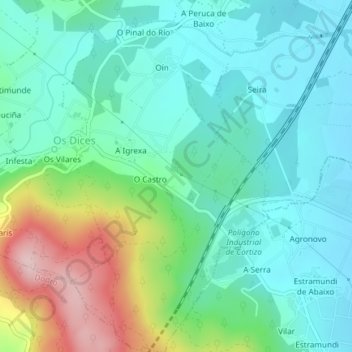
Name: Oín topographic map, elevation, terrain.

Location: Oín, Os Dices, Rois, Sar, La Coruña, Galicia, España (42.74537 -8.69479 42.77268 -8.67251)

Average elevation: 70 m

Minimum elevation: 6 m

Maximum elevation: 249 m

Gear up for your next adventure:

🧦Crew Hiking Socks - Comfortable socks for long-distance hikes
🔋Solar Power Bank - Keep your GPS and devices charged during long outdoor trips
🥾Mountain Trail Shoes - High-traction shoes for mountain trails
🧭GPS Outdoor Watch - Smart watch for navigation and fitness tracking in nature
🧭Orienteering Kit - Tools for map reading and navigation in the wild

As an Amazon Associate, this site earns from qualifying purchases at no extra cost to you.